
Voters 1
ABRP completely ignores a highway as an option
- Done
 |
Wade Johnson |
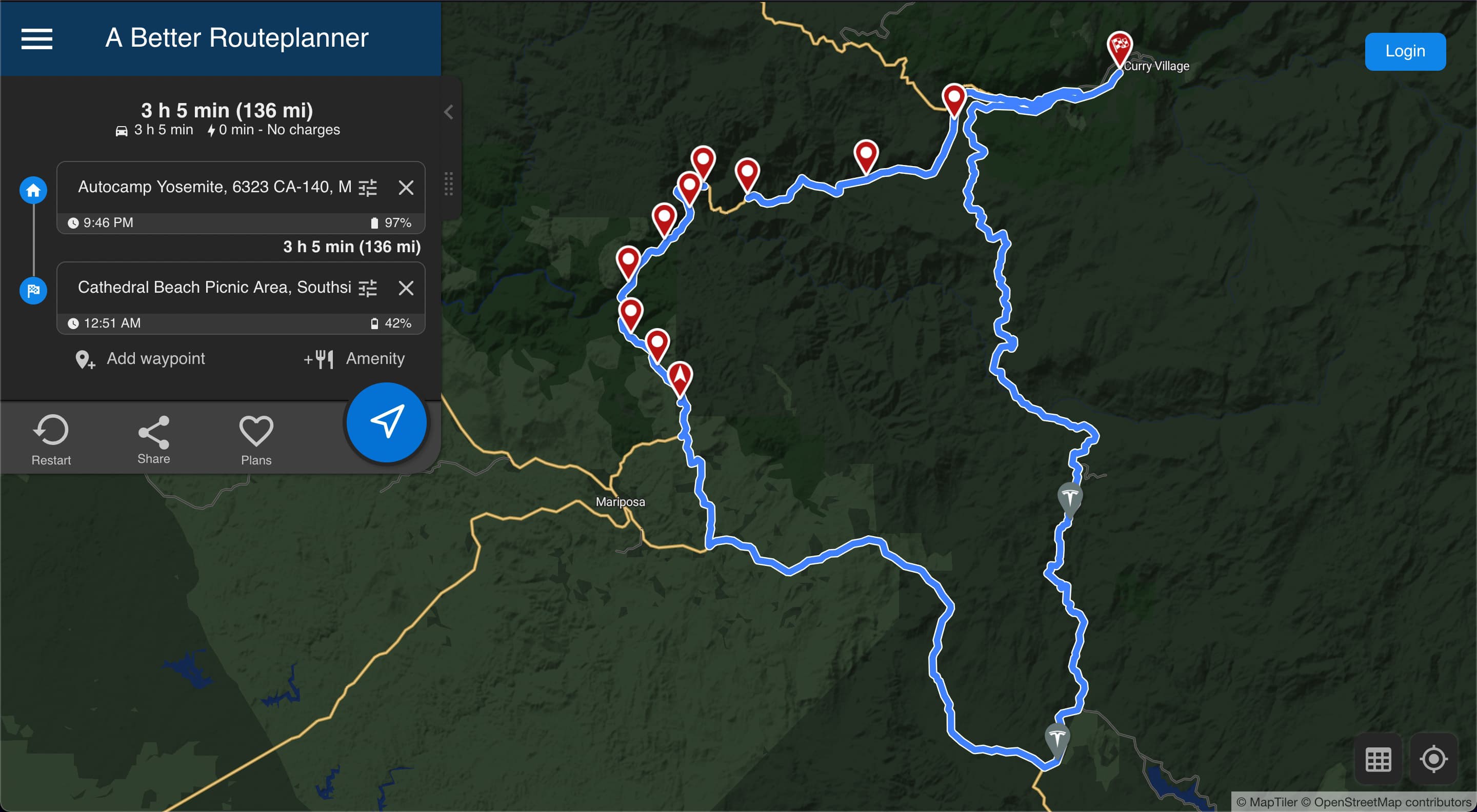
If you set your starting point at AutoCamp Yosemite (Midpines, CA), and your destination to Cathedral Beach Picnic Area, Southside Dr in Yosemite. It will always route your through Oakhurst which is waaaay out of the way. I even tried setting multiple guidepoints along Hwy 140 which is the shortest route that both Google Maps and Tesla route you through. When I set the guidepoints and calculate the trip, it goes through Oakhurst still. There is a charger in Oakhurst, but it's not needed, even according to ABRP, so I'm not sure why ABRP is routing through that town. I have not been able to get anywhere close to an accurate trip estimate for this route.
Activity Newest / Oldest
Bo_ABRP
Status changed to: Done
Bo_ABRP
The OSM data has now been updated to fix this problem and should be live on at least live traffic data maps tomorrow.
Katya_ABRP
Status changed to: User Feedback
Katya_ABRP
Hi Wade,
This is the section that appears problematic section of the route. Do you happen to know if the new road has been built here or would one be routed across the river and back as Google Maps shows? ( www.google.com/maps/dir/37.6608195,-119.9009659/37.6560082,-119.8949964/@37.6611974,-119.9011841,16.29z/data=!4m2!4m1!3e0 )
Currently we assume these circumstances but we also think the direction of the road where one is rerouted is alternating. Normally we should be able to handle this but there seems to be some form of issue specifically with the alternating direction.
/Katya
Bo_ABRP
This has been modeled in the map as "reversible" which means slowly changing direction (like once per day). But it sounds like this would be an "alternating" which means e.g. a single lane road with traffic lights. Is that the correct description for this road?
Wade Johnson
Yeah it goes across the river. I think it was single lane with traffic lights on each side, yes.
Katya_ABRP
Status changed to: Investigate
Wade Johnson
Here is a link to the plan with the mentioned waypoints: abetterrouteplanner.com/?plan_uuid=a0e17864-ded4-416b-830f-00fb6157d2ec
The road is not closed as it was the road I ended up taking and Google Maps correctly routes through that road.
Here is a link to a plan with same start/end points without the waypoints: abetterrouteplanner.com/?plan_uuid=a4a3fb16-7da5-4962-9c3a-93272046af6b
Here is a link to directions from Google Maps: www.google.com/maps/dir/AutoCamp+Yosemite,+6323+CA-140,+Midpines,+CA+95345/Cathedral+Beach+Picnic+Area,+California/@37.6336913,-119.9356118,11z/data=!3m1!4b1!4m14!4m13!1m5!1m1!1s0x8096b91fc262befb:0xecebf593b07bfd26!2m2!1d-119.9209572!2d37.5436021!1m5!1m1!1s0x8096edea42fdcfc9:0x490d0148a2d1f38a!2m2!1d-119.6251137!2d37.7229296!3e0
Katya_ABRP
Status changed to: User Feedback
Katya_ABRP
Hi Wade,
This looks like a map issue, perhaps a seasonal closure. Could you share a link to this plan (or a plan including the problematic section just) so that we may investigate this?
/Katya